Pic de Carlit: Epic French Pyrenees Lake‑to‑Summit Hike
Challenge yourself on a 14 km lake‑filled, high‑altitude route to the 2921 m summit of Pic de Carlit. A breathtaking French Pyrenees weekend hike with rugged climbs, glacial lakes and unforgettable views
Views:
1.8k
About Lac des Bouillouses to Pic de Carlit hiking
The French Pyrenees, just three hours inland from Barcelona, feel like stepping into another world — a place where the air cools, the forests thicken, and the mountains rise in jagged walls that make your pulse quicken long before the hike begins. It’s a landscape that invites you to disconnect from everything familiar and test yourself against something raw and ancient. For anyone craving a weekend that blends physical challenge with the kind of beauty that stays with you long after you’ve left, this route delivers in every possible way.
I’ve climbed Pic de Carlit twice now, and both times it pushed me to my limits. At 2921 metres, it’s the highest peak in the Eastern Pyrenees, and reaching the summit feels like earning a private moment with the mountains themselves. It’s demanding, yes — but it’s also the most rewarding hike I’ve ever done.
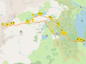
The 15‑kilometre circular route begins at 2017 metres beside the Les Bones Hores hotel/hostel, perched next to the vast 1.49 km² Lac des Bouillouses hydro‑electric reservoir. Horses graze freely around the lake, wildflowers scatter the meadows, and the early morning light reflects off the water in a way that makes the whole area feel untouched.
Planning a Stunning Weekend Getaway to Pic de Carlit
This route is physically challenging, especially the middle section where the trail steepens sharply into a rocky ascent. The final push to the summit involves scrambling over boulders and using your hands for balance. Anyone with vertigo will find this section tough, but the sense of achievement at the top is unforgettable.
Access to Lac des Bouillouses is restricted between 7am and 7pm during summer, so hikers must take the €7 shuttle bus from Pla de Barrès (départ navettes), where you’ll find parking, toilets, and the bus stop.
For a relaxed start, I recommend travelling up on Friday evening and staying at Les Bones Hores. After 7pm you can drive directly to the lake and park beside Lac des Bouillouses. Begin the ascent to Carlit Summit around 9am to enjoy the cooler morning temperatures and quieter trails.
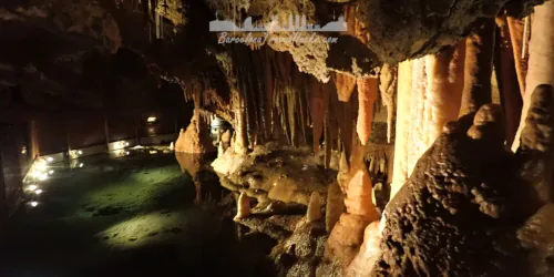
On Sunday, unwind by exploring the lakes around Lac des Bouillouses and Estanys dels Esquits, or visit the impressive Grotte Fontrabiouse caves nearby.
Image Gallery For Lac des Bouillouses to Pic de Carlit hiking
Click on any of the 60 images to open full screen gallery player. Note that viewing images is subject to our Fair Use Policy.
Visiting Lac des Bouillouses to Pic de Carlit
The trail begins beside the hotel, climbing gently along a rocky forest path before opening out onto the first lake, Estany del Viver. Its clear, deep water and stony shoreline make it an inviting place to pause, though floating algae near the edges often nudges hikers onward — and with twelve lakes on this route, saving the swim for later is a wise choice.
From Estany del Viver the path follows a lively mountain stream, rising steadily until the forest gives way to a marshy plateau crossed by wooden footbridges. The route continues alongside the river toward the second lake, Estany de les Dugues, before dipping briefly into a valley where another wooden bridge provides an easy crossing.
The ascent becomes more noticeable as the trail climbs a glacial valley between Estany Castellar and Estany De Gombau. Here the landscape opens into wide, rugged terrain, with the river weaving between boulders and alpine grass. A final footbridge leads you toward the next stretch of the route.
Skirting around Estany de Trebens, the mountains ahead begin to dominate the skyline. The trail is visible in the distance, dotted with hikers making their way upward. Passing Estany de Sobirans, the sixth lake, the gradient sharpens again as the path pushes deeper into the high mountain basin.
The climb steepens dramatically as you approach a narrow V-shaped gap between two peaks. At the top sits Estany Gelat, a tiny lake of icy water surrounded by rock. Even in August, patches of snow and blocks of ice linger here. Although the summer route never requires crampons, winter and spring hikers will absolutely need them.
Beyond Estany Gelat, the final ascent is a hands-on scramble over large boulders and broken rock. It’s slow, physical work, but reaching the summit of Carlit makes every step worthwhile. A metal cross marks the 2921‑metre peak, and the panoramic view over the chain of lakes below is one of the most spectacular in the Pyrenees.
The descent begins by retracing the upper section of the route. Near Estany Gelat, a natural five‑metre snow slide often forms beside the path — irresistible for a quick ride down on your rucksack. The lake remains shaded by high ridges, so snow and ice linger here long into the year.
As the steep rocky section eases into grassy terrain near Estany de Sobirans, the route splits. Taking the right-hand fork leads you through a quieter valley dotted with more lakes and wide open plains.
The next major lake, Estany de Vallell, appears after a gentle descent. The trail crosses a broad, shallow section of river before continuing downhill between Estany Sec and Estany de la Comassa. This is the perfect place to cool off — the cold glacial water is a relief for tired feet, and the purple heather and bright green grass make these lakes some of the prettiest in the Pyrenees.
From Estany de la Comassa the path drops steadily, rejoining the original ascent route near Estany Negre. The final stretch leads back to Les Bones Hores, where a cold beer on the terrace overlooking the meadow feels like a well-earned reward.
Pic de Carlit Mountain Hiking with a dog
This route is great with a dog and does not present any difficulties except for the final push to the summit which does involve clambering over some boulders and you may need to assist your dog here. I have made it to the summit with a dog and she loved it. No need to carry extra water for the dog because there is drinking water readily available in the streams and lakes. Be aware that there may be patches of snow, even in summer in the higher parts of the route.
The lower part of the route around the lakes does involve walking through some pine forests so be vigilant in spring and summer for poisonous Pine Processionary Caterpillars.
I awarded this route five stars for dog fun on my Hiking with a dog page.
What to take with you for Lac des Bouillouses to Pic de Carlit hiking
I take a small 30L hiking rucksack and carry around three litres of water for this route. Suncream is essential at this altitude — the sun is strong and there’s very little shade once you’re above the tree line. A hat helps keep the sun off your neck, and sturdy, comfortable hiking boots or trail shoes are a must for the rocky sections.
The weather in the Pyrenees can change quickly, even in summer, so pack a light waterproof or windproof layer. Trekking poles are optional but helpful on the steep descent. Don’t forget snacks or a packed lunch; there are no facilities once you leave the Lac des Bouillouses area.
Lac des Bouillouses to Pic de Carlit hiking Summary of Prices
Train/Bus Fare
Entry Ticket
Additional Information
Train/Bus Fare
Entry Ticket
Additional Information
Adult
€ 0.00
€ 0.00
65€ based on 4 people sharing a room for 2 nights
Child
€ 0.00
€ 0.00
Group/Family Ticket?
65€ based on 4 people sharing an apartment for two nights
Notes
Shuttle bus €7 per person. toll Tunel de Cadí (€13.93 for a car)
Getting to Lac des Bouillouses
Address: Lac des Bouillouses, Mont-Louis, France, 66210
Leave Barcelona on the C‑58 motorway, passing Sabadell and Terrassa before joining the C‑16 toward Berga. Continue north through the Pre‑Pyrenees until you reach the Túnel del Cadí (toll: €14.56 for a car). Once you exit the tunnel on the northern side, you’ll find the Àrea de Servei Túnel del Cadí – Porta Cerdanya service station — a good place to stretch your legs and snack.
Immediately after the service station, take the junction for the C‑162 toward Puigcerdà. From Puigcerdà, cross the border into France and follow the N116 to Mont‑Louis. At the Mont‑Louis roundabout, turn onto the D118 and then the D60, which leads directly to the parking area at Pla de Barrès (départ navettes), the departure point for the Lac des Bouillouses shuttle buses.
Wikiloc Trail for Lac des Bouillouses to Pic de Carlit hiking
Please sign in with Google to view the Wikiloc Route map.
Sign in with GoogleWeather for Lac des Bouillouses
Mountain Forecast weather for Pic de Carlit
Where to stay near Lac des Bouillouses
- Les Bones Hores is a mountainside hostel–hotel offering en‑suite rooms, Wi‑Fi, a bar, a restaurant, and pet‑friendly accommodation. It’s the place I always recommend for this route. The staff are welcoming, the facilities are excellent, and the food is some of the best traditional French mountain cuisine you’ll find in the area. As a guide, we paid €30 per person for a four‑bed room on the third floor. Meals are separate: breakfast is around €10, and dinner ranges from €20–30.
- Refugi de la Bollosa is a simpler, more rustic option offering communal bathrooms along with basic food and drink services.
Neither accommodation offers online booking, so you’ll need to reserve by email or phone.
Nearby Attractions to Lac des Bouillouses to Pic de Carlit
 CAR
CAR
1.6k views
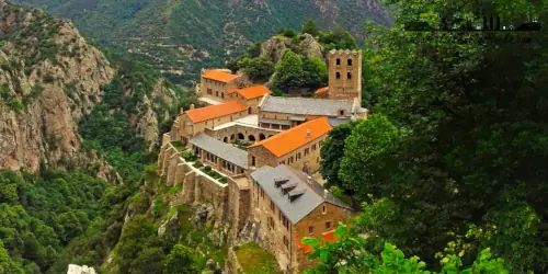
Saint‑Martin du Canigou Abbey Hike – Vernet‑les‑Bains, France
Discover the Romanesque Saint‑Martin du Canigou Abbey on a 13 km hike from Vernet‑les‑Bains, passing waterfalls, forest trails and stunning Canigou mountain scenery
Read more >
 CAR
CAR
1.5k views
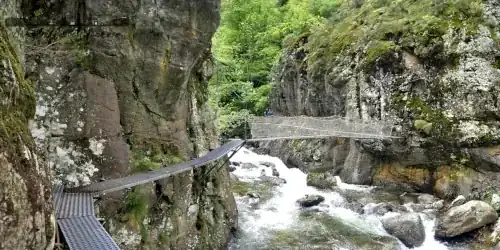
Gorges de Carançà Hike – Pyrenees Pasarelas & Suspension Bridges
A demanding 12 km hike through the Gorges de Carançà with cliff‑side pasarelas, suspension bridges, forest trails and dramatic Pyrenees canyon scenery from Thuès‑entre‑Valls
Read more >
 CAR
CAR
1.1k views