 TRAIN+BUS
2.6k views
Berguedà is a mountainous county in the province of Barcelona, forming part of the Central Catalan Pyrenees and pre-Pyrenees. Though not served by a train line, the region is well-connected by ALSA bus routes and the C-16 motorway — the main artery to the Principality of Andorra via the Túnel del Cadí.
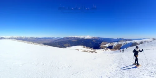
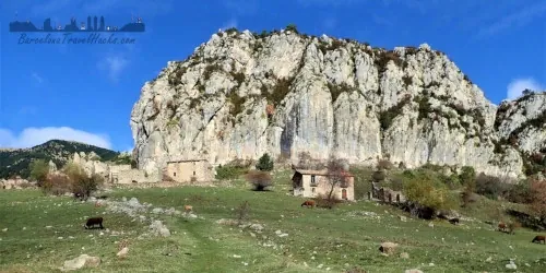
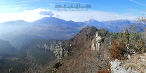
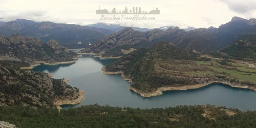
The county is a haven for hikers, with spectacular trails winding through villages like Castellar de n’Hug, Pobla de Lillet, Sant Jaume de Frontanyà, Guardiola de Berguedà, and Gósol. These stone-built settlements sit among river valleys and mountain basins that feed the headwaters of the River Llobregat — one of Barcelona’s principal rivers.
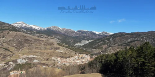
Berga, the county capital, has a population of around 16,000. Its name traces back to the Iberian Bergistani tribe, who lived here before Roman conquest. The Romans called the settlement Castrum Bergium. Hannibal subdued the Bergistani in 218 BC, but they rebelled twice — after which many were sold into slavery.
Berga later fell under Moorish rule in 715 AD, before being reclaimed by Christian forces. From 988, it was governed by viscounts and later by its own counts. Count Wifredo II de Cerdanya ruled until retiring to Canigó Monastery. After Count Bernardo Guillermo died without an heir, Berga passed to the Counts of Barcelona in 1117 under Ramón Berenguer III. The Black Plague reached Berga in 1347.
The medieval centre was built around 1360. Between 1654–1655, Berga was briefly occupied by French forces during the War of Spanish Succession. A cholera outbreak struck in 1854. Since the 1960s, Berga’s population has declined due to the mechanisation and closure of key industries — mining, textiles, forestry, livestock, and agriculture. Today, Berguedà thrives on rural tourism, with a growing network of hotels, hostels, and restaurants catering to hikers and nature lovers.
Berguedà enjoys warm, sunny summers and cold, wet winters, with an average annual rainfall of 1,000 mm. Snow is common at higher elevations. Winter temperatures often dip below freezing, while summer highs reach around 25 °C. The annual average sits between 11–13 °C.
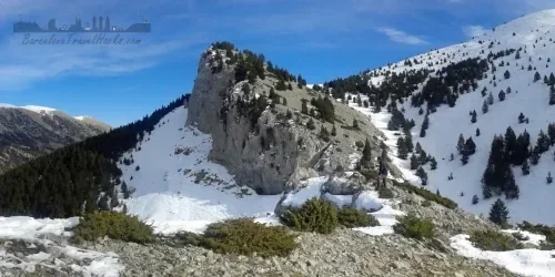
Vegetation varies by altitude and exposure. Lower slopes feature red pine and oak forests, with beech thriving in shaded areas. Fir trees appear above 1,700 m, and alpine vegetation dominates above 2,200 m. Holm oaks grow in dry, poor soils, while deeper, wetter soils support mixed oak forests. In the central and western zones, Valencian oak is prevalent; in the eastern and northern zones, Martinese oak dominates. These oak species often coexist with black and red pines.
Happy Exploring!
Click on the below images to find relevant information such as the walking route, maps, information PDFs, weather forecasts and tips about what you get to see as well as a comprehensive photo gallery for each route.
Happy Exploring!
TRAIN+BUS
 CAR
CAR
 TRAIN
TRAIN
 CAR
CAR
 CAR
CAR
 CAR
CAR
 CAR
CAR
 CAR
CAR