Wikiloc trail navigation app & Barcelona Travel hacks Routes
What is wikiloc and how does it work? Using wikiloc to navigate hiking trails. Barcelona Travel Hacks city, Coastal and mountain walking trails
Views:
6.5k
What is & About Wikiloc Web and Mobile app
Wikiloc.com is a community of users who record and upload their GPS trails for sports such as hiking, skiing, cycling, canoeing, rafting and more. Catalunya has some of the finest mountain trails, coastline and rivers in Spain, so there is an abundance of trails for the region.
I, along with many others, have trails for walks in Catalunya and they can be found on the wikiloc website or by cliking on the Wikiloc link on each hiking route page.
How does Wikiloc work?
You download the Wikiloc navigation app on your phone, and it converts your smartphone into a portable GPS navigation device similar to a Garmin.
The application uses offline maps that you download. I have the Spain map on mine. The map files are large (897.78 MB for the Spain map, 175.58 MB for the Spain–Catalunya map), so you need a phone with enough free memory. You can download multiple maps to your device.
The app has a search function to help you find trails. You can save a trail to your phone, and it will overlay on the downloaded map. When you arrive near the start of the trail, you launch the app and it guides you along the route. If the route is well written, it will include waypoints indicating where to turn or change paths. The Wikiloc app notifies you with chimes when you approach a waypoint and issues a warning alert if you wander off the trail.
Navigation works independently of mobile coverage because both the map and the trail are stored on your phone, so you don’t need to worry about losing signal in remote areas.
The Wikiloc app is available in English, Spanish, Catalan, French, Italian, Portuguese, German, Dutch and Russian.
Wikiloc has many more useful features, which you can read about on the website.
How much does Wikiloc cost?
You can try Wikiloc free for 14 days. After that, the subscription is €19.99 per year. Note that I am in no way sponsored or paid by Wikiloc — it is simply my go‑to app for hiking navigation, and I highly recommend it.
Once you have an account, you can also log in via a desktop web browser to explore trails and select which ones to download and save to your phone using a QR code.
Barcelona Travel Hacks Top Tips
Warning: You cannot use Google Maps for mountain hiking or other rural sports because Google Maps does not include rural paths and tracks. For safety — and to avoid getting lost in the mountains — you should use a navigation device like Wikiloc or a Garmin.
Advice: When you use the app to follow a trail, you must have GPS enabled on your phone. The app constantly uses GPS data to track your progress and location on the trail and map. This drains the battery much faster than normal. Ensure your phone is fully charged before starting a trail. I also recommend carrying a portable USB power pack in case the GPS usage drains your battery halfway through a hike.
Barcelona Travel Hacks Wikiloc Urban Routes List
a0187 - Tarragona Pont del Diable
Preserved Roman aquaduct crossing Barranc del Diable river valley within parkland on the outskirts of Tarragona
Transport: Regional + Bus Fare: €3.40 Distance: 1.70 km Difficulty: Easy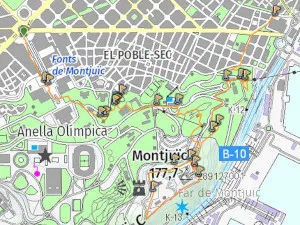
BCN01 - Montjuic castle and gardens
A city walk in the Gardens of Montjuic passing via Venetian towers, Magic fountains, Museum of Catalan Art (MNAC), Greek theatre, Montjuic Castle ans Miramar cable car.
Transport: Metro Fare: T-Casual Zone 1 Distance: 7.37 km Difficulty: Easy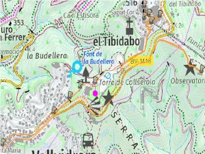
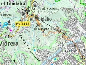
BCN02 - Tibidabo
Circular route covering the attractions of Tibidabo - Funiculars Tibidabo and vallvidrera, Torre Collserola, Tibidabo church, Parc de Atracciones and Fabra Observatori.
Transport: Metro Fare: T-Casual Zone 1 Distance: 5.39 km Difficulty: Easy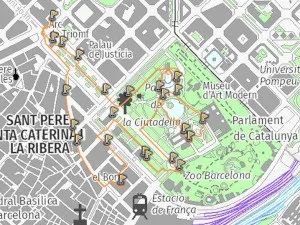
BCN03 - Arc de Triomf, Citadella Park, Zoo, La Ribera
Circular city walk in Barcelona via Arc de Triumf, Par cuitadella, Catalan Parliament, Barcelona Zoo, Born Cultural Centre, Chocolate museum and abandoned monastaery.
Transport: Metro Fare: T-Casual Zone 1 Distance: 3.96 km Difficulty: Easy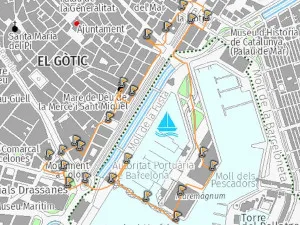
BCN04 - Historic Port of Barcelona
City walk in Barcelona in Old port area via Maritime museum, Torre Colon, Maremagnum shoping centre, Boat tours, Post office, Our lady of Mercy Basilica and Wax museum.
Transport: Metro Fare: T-Casual Zone 1 Distance: 3.69 km Difficulty: Easy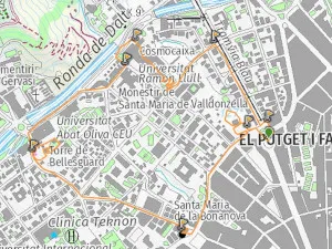
BCN05 - Torre Bellesguard - Science Museum
Circular city walk in Barcelona via Sant Gervasi church, Torre bellesguard, CosmoCaixa science museum, Avenida Tibidabo and Tamarita Gardens.
Transport: Metro Fare: T-Casual Zone 1 Distance: 3.85 km Difficulty: Easy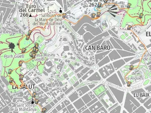
BCN06 - Parc Guell and Carmel Bunkers
City walk in Barcelona from Plaza Leseps in Gracia to Parc Guell then on to Carmel bunkers and park Guinardo finishing at Alfonso X Metro.
Transport: Metro Fare: T-Casual Zone 1 Distance: 5.82 km Difficulty: Easy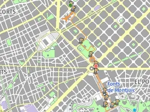
BCN07 - La Modelo Prison - Parc Joan Miro - Arenas Shopping Centre
City walk in Barclona in the Eixampla Right area passing via La Modelo former prison museum, Park Joan Miro and Arenas former bull ring shopping complex at plaza Espana.
Transport: Metro Fare: T-Casual Zone 1 Distance: 4.41 km Difficulty: Easy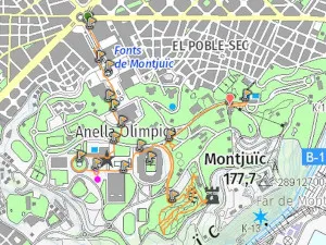
BCN08 - Olympic Montjuic
City walk in barcelona via Olimpic Montjuic. Museum of Catalan Art (MNAC), Palau Jordi, Olimpic Stadium, Botanical gardens, Olympic museum of sport and Olympic diving pools.
Transport: Metro Fare: T-Casual Zone 1 Distance: 7.07 km Difficulty: Easy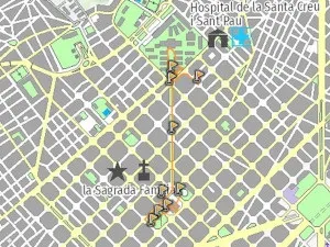
BCN09. Sagrada Familia - Aveninda Gaudi - Recinte Modernista Sant Pau
A city walk in the Sagrada Familia area of Barcelona via La Sagrada Familia, Avenida Guidi and Recinte Modernista de Sant Pau.
Transport: Metro Fare: T-Casual Zone 1 Distance: 2.46 km Difficulty: Easy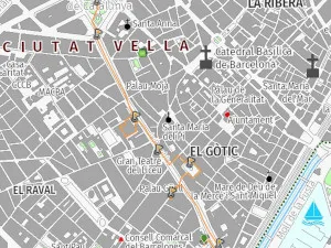
BCN11 - Palau Guell, Las Ramblas, Plaza Reial, plaza Catalunya
A city walk in Las Ramblas area of Barcelona via Palau Guell, Plaza Reial, Liceo Theatre, La Boqueria Sant Josep food market, las Ramblas and Plaza Catalunya
Transport: Metro Fare: T-Casual Zone 1 Distance: 2.22 km Difficulty: Easy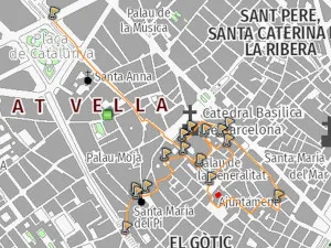
BCN12 - Barcelona Gothic Quarter
A City walk around the gothic qurter of Barcelona via The cathedral, Frederic Mares Museum, Barcelona Histrory Museum, Roman wall Remains and Playing cards Museum.
Transport: Metro Fare: T-Casual Zone 1 Distance: 4.13 km Difficulty: Easy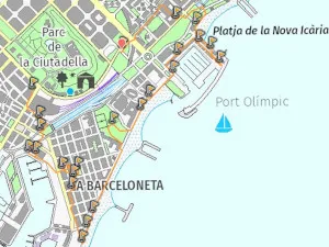
BCN13 - Barceloneta Area
A city walk in the Barceloneta area pasing via Estacion de franca, History of Catalunya Museum, Sant miquel church, Beaches, Miramar cable car and port Olimpic.
Transport: Metro Fare: T-Casual Zone 1 Distance: 6.37 km Difficulty: Easy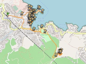
a0278 - Collioure Beach Town in France with Fortresses
An easy 8Km circular town route in Collioure via El barri de Moure, Historic Port and church, Chateu Royal and Fort Sant Elme and beaches
Transport: Regional + SNCF Fare: €42.00 Distance: 8 km km Difficulty: Easy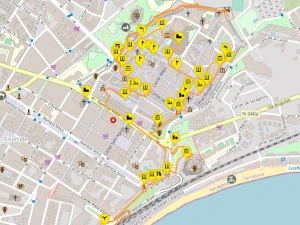
tar01 - Roman Tarragona (Part Alt)
A city walk in Tarragona (part Alt) that covers the main Roman Museums that are part of the MHT (Museo Historico de Tarragona).
Transport: Regional Fare: €20.10 Distance: 5.21 km Difficulty: Easy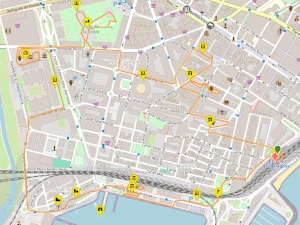
tar01 - Roman Tarragona (Part Baix)
A city walk in Tarragona (part Baix) that covers the main Roman Museums and Port Serrallo area
Transport: Regional Fare: 2€0.10 Distance: 6.69 km Difficulty: Easy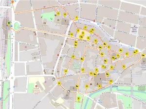
vic01 - Vic Medieval Town Centre Walking Guide
The buildings, squares, streets & points of interest on a historic walking route through medieval Vic town centre
Transport: Rodalies or Bus Fare: €17.10 Distance: 3.75 km Difficulty: EasyBarcelona Travel Hacks Wikiloc Routes Near Cities List
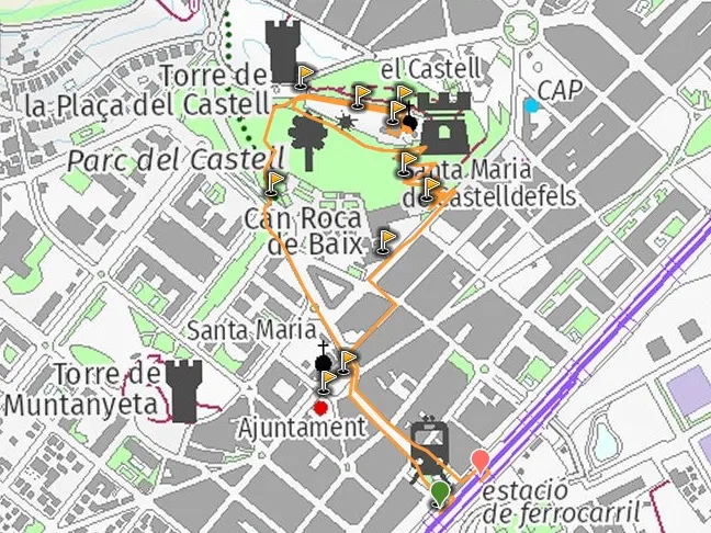
a0141 - Castelldefels Castle and park
A short 2.7Km route from Castelldefels station to the 10th Century restored coastal castle to visit the Church, gardens and 19th century spectacular Noble floor.
Transport: Rodalies Fare: T-Casual Zone 1 Distance: 2.77 km Difficulty: Easy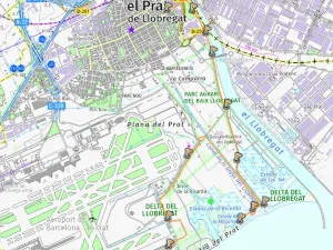
a0143 - Delta Llobregat Park to Prat Beach
Barcelona Airport, El prat, is surrounded by a wetland nature reserve. Starting in the town and ending at the beach walking or cycling via the nature reserve.
Transport: Metro Fare: T-Casual Zone 1 Distance: 11.36 km Difficulty: Easy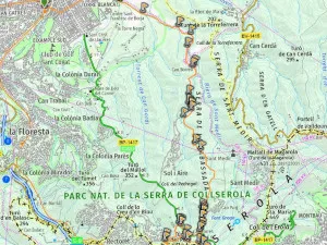
a0144 - Abandoned Hotel - Casino de Rabassada
Parc Collserola Walk from Sant Cugat via Sant Medir chappel, viaduct, Abandoned Casino and hotel Arrabassada, tibidabo and Vallvidrera.
Transport: FGC Fare: T-Casual Zone 1 Distance: 14.64 km Difficulty: Moderate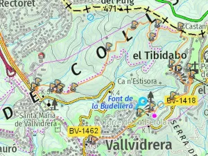
a0145 - Sant Cugat Monastery - winery
Parc Collserola walk from Sant Cugat via Sant cugat Monastery and wine cellar, Can Borrell, Sant Medir Chappel and finishing at Metro Vall de Hebron.
Transport: FGC & Metro Fare: T-Casual Zone 1 Distance: 12.74 km Difficulty: Easy
a0146 - Vila Joana in Parc Collserola
Walk in Parc collserola passing via Vila Joana Museum, Forest trails and Tibidabo. Returning via torre collserola and Funicular de Vallvidrera
Transport: FGC Fare: T-Casual Zone 1 Distance: 5.82 km Difficulty: Easy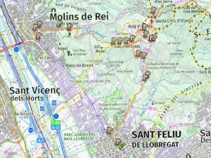
a0147 - Sant Feliu abandoned Cement Factory
Walk in Parc Collserola passing via Sant Sant Feliu abandoned cement factory and open mines, Sant Creu d'Olorda and Castellciuro castle ruins.
Transport: Rodalies Fare: T-Casual Zone 1 Distance: 13.27 km Difficulty: Easy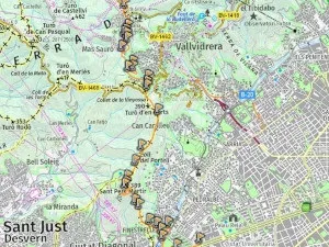
a0148 - Sant Pere de Martir - Valvidrera Reservoir
A walk along the collserola ridgeline via Barcelona Zona Universitaria, Rose garden, Sant pere de martir telco tower, Vallvidrera, forest trails and Reservoir.
Transport: Metro & FGC Fare: T-Casual Zone 1 Distance: 7.1 km Difficulty: Easy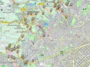
a0149 - Complete Caraterra de Aiguas Running, Cicyling or walking trail
A great walking, running and cycling route in the collserola foothills with spectacular views of Barcelona city. Accessible from multiple points in Barcelona City.
Transport: Metro & FGC Fare: T-Casual Zone 1 Distance: 12.0 km Difficulty: Easy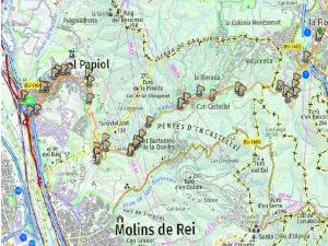
a0150 - Collserola La Rierada to Escaletes and El Papiol
beautiful 12km EASY walking route in the collserola natural park following the vallvidrera river via sheltered forest trail with waterfalls and variety of trees and wild flowers.
Transport: FGC & Rodalies Fare: T-Casual Zone 1 Distance: 12.0 km Difficulty: Easy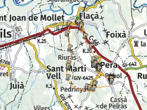
a0204 - Gala Dali castle home and La Pera vilage
13km EASY circular walking route from Flaca to Dala Gali's castle home in Pubol. The route passes via farmland, La Pera village and Pedrinya hamlet.
Transport: Regional Fare: €26.30 Distance: 13.67 km Difficulty: Easy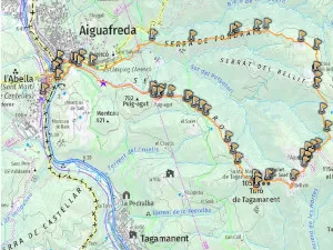
a0226 - Tagamanent castle Summit
A circular mountain walk via Puig-Agut, Tagamanent Castle ruin, Sant Marti Ruins, Bellver farmhouse, Rural house and museum L?Augusti, Bellit and Fondrats ruined farmhouse.
Transport: Rodalies Fare: €8.40 Distance: 16.22 km Difficulty: Moderate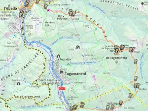
a0234 - Tagamanent castle ruin from Figaro
Linear route from Figar? to Sant Mart? de Centelles going up Valcarquera river valley to Bellver Farmhouse Restaurant and Tagamanent Castle ruin via forestal paths.
Transport: Rodalies Fare: €9.20 Distance: 13.82 km Difficulty: Moderate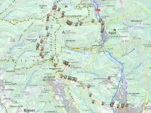
a0235 - La Garriga to Figaró via Cingles de Bertí
Spectacular views of the Congost river valley via rural church and telegraph watchtower, A ruined castle, views of los Cingles de Bertí cliff face, a waterfall and small cave.
Transport: Rodalies Fare: €9.20 Distance: 16.61 km Difficulty: ModerateBarcelona Travel Hacks Wikiloc Mountain Routes List
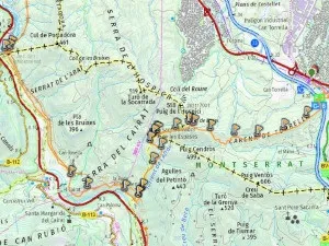
a0153 - La Puda Abandoned Thermal Baths
A walk in the mountains near Montserrat starting at Vacarisses via Sant Salvador mountain top chappel and La puda Abandoned thermal baths.
Transport: Rodalies & FGC Fare: €10.25 Distance: 10.72 km Difficulty: Easy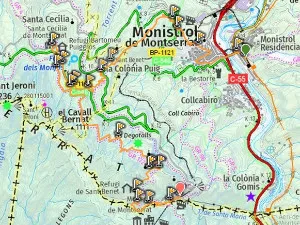
a0154 - Abandoned Hotel Colonia Puig to Montserrat Monastery
A walk in the Montserrat mountains via Monistrol, Sant Bennet Monastery, Abandoned hotel Colonia Puig, Sant Cec?lia, Sant Benet Chapel and Motserrat monastery.
Transport: FGC & cable car Fare: €18.50 Distance: 10.98 km Difficulty: Moderate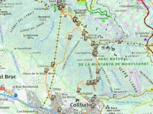
a0155 - Sant Jeroni from Colbato via Bus
A walk in Montserrat mountains from Colbato via Sant Joan Chapel and hermatige, s Sant Onofre Hermatage, Sant Jeroni Hermitage and La Vinyanova.
Transport: Bus Fare: €12.00 Distance: 16.75 km Difficulty: Moderate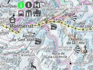
a0156 - Montsearrat Easy Santa Cova walk
An EASY 1.4 KM walking route from Montserrat Monatery via Cami de la Santa Cova to the Santa Cova chapel passing via monuments and sculptures with a distinctly religious theme. Return via same path.
Transport: FGC & Cremallera Fare: €24.00 Distance: 1.42 km Difficulty: Easy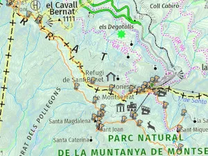
a0157 - Sant Jeroni from Montserrat Monastery
An EASY-MEDUIM circular route Montserrat Monastery to Sant jeroni Sumit viewpoint via Santa Anna, Sant Jerioni, Santa Magdalena, Sant Joan and Sant Miquel hermitages.
Transport: FGC & Cremallera Fare: €24.00 Distance: 11.9 km Difficulty: Moderate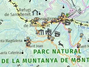
a0158 - Easy Montserrat Walking route
A circular walk from Montserrat monastery via Santa Anna Hermitage ruins, Sant Joan Chapel and hermatige, Sant Miquel chappel and cross viewpoint.
Transport: FGC & cable car Fare: €33.45 Distance: 7.07 km Difficulty: Easy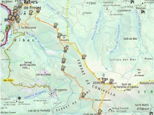
a0210 - Taga Summit from Ribes de Freser
A circular mountain walk through forests and grazing hills to a summit with spectacular 360 degree views.
Transport: Rodalies Fare: €18.20 Distance: 17.41 km Difficulty: Moderate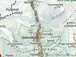
a0211 - Ribes de Freser to Vall de Nuria
A linear route uphill via a spectacular mountain valley passing via querlabs mountain village and mulltiple waterfalls to get to Nuria Resort.
Transport: Rodalies & Cremallera Fare: €33.50 Distance: 14.99 km Difficulty: Moderate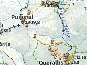
a0212a - Puigmal sumit from Vall de Nuria
A circular route starting in the pyrenees resort of Nuria to the top of the world (Puigmal summit) via forest paths, montain grazing hills and rocky peek.
Transport: Rodalies & Cremallera Fare: €33.50 Distance: 9.03 km Difficulty: Moderate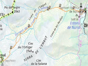
a0212b - Nuria Resort to Puigmal to Queralbs
A hard linear route starting in Nuria to the top of the world (Puigmal summit) via forest paths, montain grazing hills and rocky peek returning via queralbs.
Transport: Rodalies & Cremallera Fare: €33.50 Distance: 18.7 km Difficulty: Moderate
a0213 - Toses to Planoles via Serra de Montgrony
Ridge route starting Toses Renfe station and ending Planoles Renfe. Spectacular views of the high pirineo mountain tops and ski resorts.
Transport: Rodalies & Cremallera Fare: €21.00 Distance: 12.77 km Difficulty: Moderate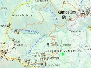
a0216 - Snow Shoe Hiking in Serra de Montgrony
17Km Circular snow shoe hiking route from Campelles village near Ribes de Freser in the Serra de Montgrony mountain range
Transport: Rodalies + Taxi Fare: €28.20 Distance: 14.64 km Difficulty: Moderate
a221 - Santuari de Cabrera viewpoint, chapel and rural Restaurant Hostel
12km circular Autumn & winter medium hiking route in Collsacabra mountains to a hill top sanctuary via cliff top paths & forested trails with great viewpoints
Transport: Car Fare: €25.00 Distance: 12.19 km Difficulty: Moderate
a0222 - Santuari de Bellmunt viewpoint chapel restaurant
Medium hard linear route to Santuari de Bellmunt from Saint Quirze de Besora returning to Torello via forest ridge path and castllet
Transport: Rodalies Fare: €12.60 Distance: 19.39 km Difficulty: Moderate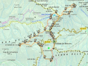
a0223 - Magical Forest Fageda De La Grevolosa autumm colours hike
Circular 14km car accessible hiking route following a ridgeline ascent and going down via one of the most beautiful forests in Catalunya
Transport: 1 to 2 hours by Car Fare: €20.00 Distance: 14.50 km Difficulty: Moderate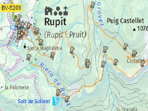
a0224 - Medieval Rupit, waterfalls, Cingles de Pujolras cliffs
Easy 11Km circular hike from Rupit via Sallent 100m waterfall, Cingles de Castellet cliffs and Castell De l'Envestida viewpoint
Transport: 1 to 2 hours by Car Fare: €20.00 Distance: 10.27 km Difficulty: Easy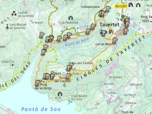
a0225 - Tavertet - Moli Bernat waterfall - Morro del Abella
One of the most emblematic hikes in Catalunya under a waterfall via a cliff path with ladders & spectacular viewpoints of panta de Seu Reservoir.
Transport: 1 to 2 hours by Car Fare: €20.00 Distance: 12.07 km Difficulty: Moderate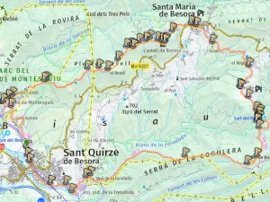
a0227 - Sant Quirze de Besora - Montesquiu - Castles and Waterfall
A beautiful route that includes Montesquiu Castle, ruined castle of Besora, Besora village, Mir waterfall and abandoned Mill. Forest paths and ridgeline views.
Transport: Rodalies Fare: €12.60 Distance: 18.48 km Difficulty: Moderate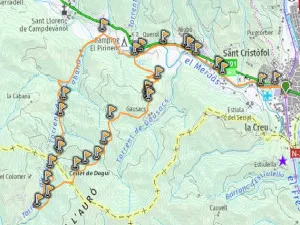
a0228a - The 7 Waterfalls of Campdevanol
A circular route via a river valley with 7 waterfalls - La Cabana, La Tosca, L'Olla, La Bauna, Del Forat, El Petit Colomer and El Gran Colomer. Return via Gausacs Farm.
Transport: Rodalies Fare: €18.20 Distance: 13.34 km Difficulty: Moderate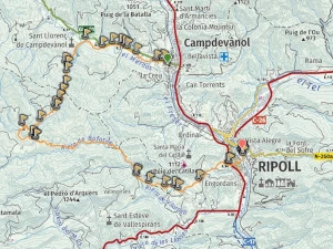
a0228b - The 9 Waterfalls of Campdevanol to Ripol
A linear route from campdevanol via a river valley with 7 waterfalls - La Cabana, La Tosca, L'Olla, La Bauna, Del Forat, El Petit Colomer and El Gran Colomer. Return via Ripoll.
Transport: Rodalies Fare: €18.20 Distance: 20.68 km Difficulty: Moderate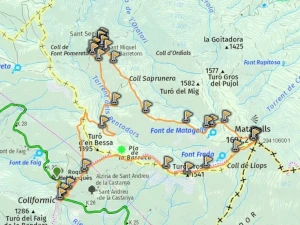
a0261 - Montseny Coll Formic to Matagalls
Outstanding beauty & spectacular hiking trails to mountain summits, cliffs, rivers, waterfalls, plains & woodlands. The best place for autumn hiking in Catalunya
Transport: Rodalies + Bus Fare: €10.80 Distance: 12.47 km Difficulty: Moderate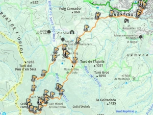
a0262 - Montseny Valldrau to Sant Segimon & waterfalls
16 Km circular hiking route to Sant Segimon Monastery Restaurant via forest trails and waterfalls. Famous for the Viladrau Chestnut fair.
Transport: Rodalies + Bus Fare: €10.80 Distance: 15.88 km Difficulty: Moderate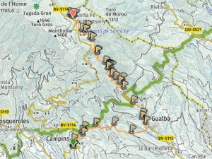
a0263 - Montseny River Gualba Waterfalls to Santa Fe
16Km medium-hard linear uphill autumn hike via Santa Fe & Gualba rivers, waterfalls, forests & a reservoir. Option to stay overnight in Santa Fe.
Transport: Rodalies + Bus Fare: €10.80 Distance: 15.81 km Difficulty: Moderate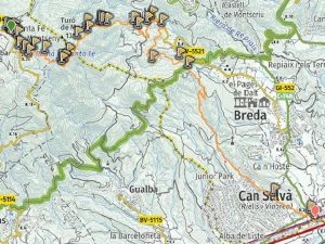
a0264 - Montseny Santa Fe to Breda via Sant Marti de Riells
18Km medium-hard linear downhill autumn or summer hike from Santa Fe reservoir to Riells and Breda via forests & rivers with valley views.
Transport: Rodalies + Bus Fare: €10.80 Distance: 18.79 km Difficulty: Moderate
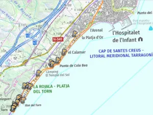
a0268 - Mola de Colldejou plateau
A Circular walk in Llaberia natural park to the Mola de Colldejou Plateau via Forest trails and steep ravine to pass via abandoned ruined watchtower.
Transport: Rodalies Fare: €23.90 Distance: 17.13 km Difficulty: Moderate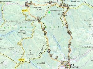
a0269 - Pratdip in Llaberia Natural Park
Hiking in the hellhound & vampire village of Catalunya. A medium hard 15km circular route in the Llaberia Natural Park.
Transport: Regional + Taxi Fare: €29.50 Distance: 14.39 km Difficulty: Moderate
a0270 - Montsant Escaladei and Clot del Cirer
Spectacular mountain route from former grand monastery via Montsant cliffs & mountain plateau via Clot del Cirer natural spring & Roca de miso viewpoint
Transport: Car Fare: €20.00 Distance: 14.17 km Difficulty: Moderate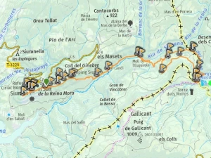
a0271 - Natural Pools & waterfalls of Siurana
Beautiful late spring or summer walking route from a mountain top village around a river basin with various waterfalls and natural swimming pools
Transport: Car Fare: €20.00 Distance: 12.5 km Difficulty: Easy
a0288 - Cingles de Malanyeu circular
Circular route via enchanting beach & oak forests to a ridgeline path with views of the high Pyrenees including Pedraforca plus secret waterfall desent path
Transport: Car Fare: €25.00 Distance: 13.31 km Difficulty: Medium
a0289 - peguera abandoned mining vilage and Roca-Blanca
13km circular hiking route from abandoned village of Peguera to Roca Blanca & Gallina Pelada summits plus Museu de les Mines de Cercs
Transport: Car Fare: €25.00 Distance: 12.69 km Difficulty: Moderate
a0290 - Vall de Lord circular route from Sant Llorenç de Morunys
14km medium-hard circular route from Ermita de Sant Serni del Grau passing via Cingles de Vilamala caves & Santuari de Lord mountain top monastery
Transport: Car Fare: €25.00 Distance: 13.93 km Difficulty: Medium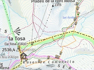
a0296 - Easy Snowshoe hike to La molina Refugi Niu de Aliga
Getting to La Molina Ski Resort by public transport, information about the activities and services, Snow shoe activity for beginners
Transport: Rodalies + Bus Fare: €28.00 Distance: 3.52 km Difficulty: Easy
a0297 - Urtx-Alp to La Molina Mushroom hunting hike
10km easy linear Autumn Mushroom hunting hike in Bosc del Carboner Mort between Urtx-Alp and La Molina and the mushroom culinary culture of Catalonia
Transport: Rodalies Fare: €23.00 Distance: 10.58 km Difficulty: Easy
a0290 - Catllaràs Forest Winter Hiking in Secret Gaudí Town
La Poble de lillet contains two secret Gaudí works, a cement museum & tourist train as well as a great forest for mushroom picking, hiking & snowshoe
Transport: Car Fare: €25.00 Distance: 17.68 km Difficulty: Medium
a0302 - Pedraforca circular mountain route
Second most famous mountain in Catalunya. Pre-Pyrenees twin peaked summit medium circular 14km hiking route for summer or winter
Transport: Car Fare: €20.00 Distance: 13.90 km Difficulty: Moderate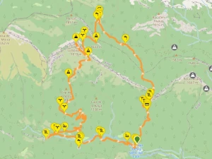
a0303 - Parc Natural del Cadí-Moixeró waterfalls
Medium-Hard 15km Cadí-Moixeró natural park circular route via Bullidor de la llet & Els Empedrats waterfalls, Sant jordi Hostel & Boixasa summit
Transport: Car Fare: €25.00 Distance: 15.08 km Difficulty: Medium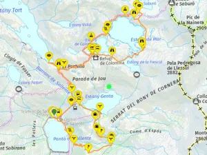
a0304 - Aigüestortes Vall de Fosca Lakes and Reservoirs
Spectacular 14km circular hiking route via seven glacial lakes in high mountains of Aigüestortes Vall de Fosca using a cable car to climb to Estany Gento
Transport: Car Fare: €20.00 Distance: 14.80 km Difficulty: Moderate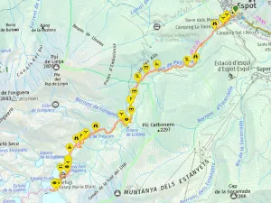
a0305 - Aigüestortes Vall de Peguera Black Lake and Reservoirs
A challenging 15km circular hike from Espot to black lake, Refugi JM blanc & Tort de Peguera lake in Aigüestortes natural park via the Peguera river valley
Transport: Car Fare: €20.00 Distance: 15.12 km Difficulty: Moderate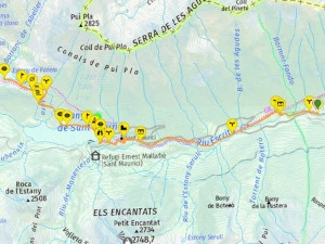
a0306 - Aigüestortes Sant Maurici Lake and Ratera Waterfall
Easy 12Km linear hiking route along Río Escrita to Estany Sant Maurici (largest Aigüestortes lake), Cascada de Ratera waterfall & Estany Ratera
Transport: Car Fare: €20.00 Distance: 11.89 km Difficulty: Easy
a0335 - Salto de Bierge river hike
10Km circular amphibious hike along the natural pools of Alcanadre River to the Bierge dam. A refreshing hike for the Summer in Aragon near to Catalan border
Transport: Car Fare: €25.00 Distance: 9.52 km Difficulty: Medium
a0336 - Alquézar River Vero and Pasarelas metal Walkways
Discover spectacular Alquézar village & complete a 13km circular hiking route via River Vero walkways in Sierra y Cañones de Guara Natural Park
Transport: Car Fare: €25.00 Distance: 12.44 km Difficulty: Medium
a0337 - Adhuesca early morning exploring
Small charming historic medieval village ideal for an overnight stay in Huesca when visiting Alquézar & Salto de Bierge. Great food & accommodation
Transport: Car Fare: €25.00 Distance: 3.33 km Difficulty: Medium
a0338 - Rivers of Aragon II - Congost de Mont-rebei kayak
Kayak the stunning turquoise waters of Congost Mont-Rebei canyon along the Noguera Ribagorçana river from La Masieta parking to Montfalcó stairs
Transport: Car Fare: €25.00 Distance: 19.09 km Difficulty: Medium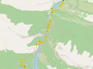
a0339 - Rivers of Aragon II - Congost de Mont-rebei Hiking
Hike along cliff side ravine path across Montfalcó suspension bridges & mountain side Montfalcó stairs along the congost de Mont-rebei valley
Transport: Car Fare: €25.00 Distance: 17.23 km Difficulty: Medium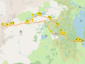
a0346 - Llac de les Bulloses to Pic Carlit
14km Medium-Hard vertigo inducing circular mountain hiking routevia lakes of the lac de Bouillouse french Pyrenees region to the 2921m Pic de Carlit summit
Transport: Car Fare: By Car Distance: 14.82 km Difficulty: Difficult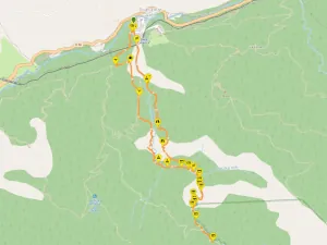
a0348 - Gorges de Carança River Hike
14km circular scenic hike along Carançà river valley via suspension bridges and canyon side walkways along a forested Pyrenees mountain river
Transport: Car Fare: By Car Distance: 12.0 km Difficulty: Medium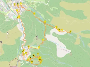
a0349 - Saint-Martin du Canigou Abbey
13Km circular hike from Vernet-les-Bains via forest waterfalls to the 11th Century Saint-Martin du Canigou Abbey and viewpoints in the Canigou mountains
Transport: Car Fare: By Car Distance: 13.04 km Difficulty: Medium
a0356 - Andorra's Vall de Incles Pyrenees Mountain Hiking
Considered one of the most beutiful hiking areas in Andorra. A forrestal ascending walk leads to a mountain plain with lakes and waterfalls
Transport: Car Fare: 35 Distance: 13.31 km Difficulty: Medium
a0357 - Andorra's Pic de pessons Pyrenees Mountain Hiking
12km medium-hard circular hiking route of pysically demanding valley ascent to ridgeline peeks and descending via rocky boulder strewn landscape with lakes
Transport: Car Fare: 35 Distance: 11.82 km Difficulty: Hard
a0376 - Garrotxa Volcanic Zone Santa Pau medieval village Hiking
13km Medium circular route from Santa Pau village to Santa Maria de Finestres mountain top church and castle ruins via ancient forests and volcanos
Transport: CAR Fare: €25.00 Distance: 13.28 km Difficulty: Meduim
a0377 - Garrotxa Volcanic Zone Les Planes d'Hostoles waterfalls
13km circular route via Gorges of Les Planes d'Hostoles, Hostoles castle ruin, Cogolls hamlet & Molí dels Murris plus Can Poetí Gorges
Transport: CAR or BUS Fare: €25.00 Distance: 12.89 km Difficulty: Meduim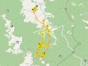
a0378 - Garrotxa Volcanic Zone Els Hostalets d'en Bas waterfalls
Autumn 10km circular hiking paradise through ancient forests via waterfalls and cliff viewpoints from pituresque medieval village
Transport: CAR Fare: €25.00 Distance: 10.43 km Difficulty: Meduim
a0282 - Alta Garrotxa Sadurnes waterfalls hiking and swimming
A stunning 15km circular route from Sadurnes via natural pools & waterfalls of Sant Aniol d'Aguja river valley with watermill ruins, stone farmhouses & chapels
Transport: CAR Fare: €35.00 Distance: 15.35 km Difficulty: MeduimBarcelona Travel Hacks Wikiloc Coastal Routes List
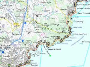
a0175 - Camí de la Ronda GR-92 - Palamós to Calella de Palafrugell - DAY 1
Day 1 of a three day walking route along the most beutiful section of the costa Brava via the GR-92 trail known as la Ronda. Start in Palamos and end in Callella de palafrugell.
Transport: Moventis Bus Fare: €17.45 Distance: 11.77 km Difficulty: Easy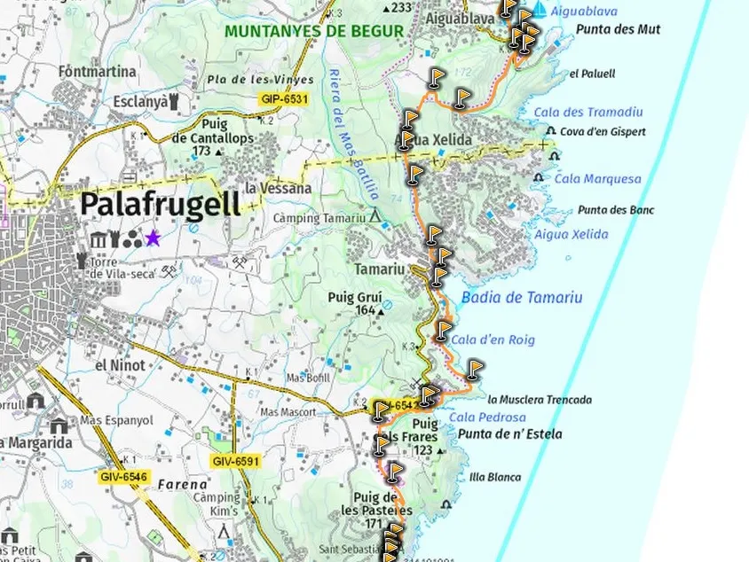
a0176 - Camí de la Ronda GR-92 - Calella de Palafrugell to Aiguablava - DAY 2
Day 2 of a three day walking route along the most beutiful section of the costa Brava via the GR-92 trail known as la Ronda. Start in Callella de palafrugell and end in Aiguablava or Fornells.
Transport: N/A Fare: N/A Distance: 10.85 km Difficulty: Easy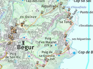
a0177 - Camí de la Ronda GR-92 - Aiguablava to Begur - DAY 3
Day 3 of a three day walking route along the most beutiful section of the costa Brava via the GR-92 trail known as la Ronda. Start in Aiguablava or Fornells and end in Begur.
Transport: Moventis Bus Fare: €19:85 Distance: 10.11 km Difficulty: Easy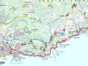
a0180 - Garraf to Sitges walk
A Linear route from Garraf to Sitges via mines, Can Lluca Farmhouse, Campdasens, Can L'Amell, Trinitat Hermitage and Vallcarca telecoms tower.
Transport: Rodalies Fare: €8.05 Distance: 14.76 km Difficulty: Easy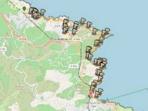
a0279 - Colliure to Banyuls-sur-Mer Coastal Hike
17Km Medium-hard Linear Cote Vermeille (France) coastal hike via Port Vendres & Cap bear lighthouse along rocky exposed coastal path with beautiful beaches.
Transport: Regional + SNCF Fare: €42.00 Distance: 16.93 km Difficulty: Moderate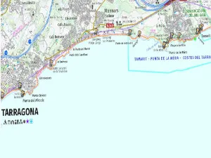
a0325 - Torredembarra to Tarragona Coast walk
A linear Costal walk in Tarragona via Beaches, light houses, watchtower, Roman Ruins Vila dels Munts, Tamarit Castle and Abandoned Hospital de Arrabassada.
Transport: Regional Fare: €16.10 Distance: 17.97 km Difficulty: Moderate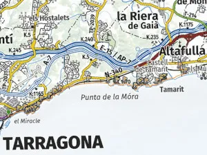
a0326 - Tarragona to Altafulla-Tamarit Coastal Walk
A linear Coastal walk from Tarragona via Abandoned Hospital de Arrabassada, Beaches, coves, watchtower, pine forest trails and Tamarit Castle.
Transport: Regional Fare: €16.10 Distance: 13.74 km Difficulty: Easy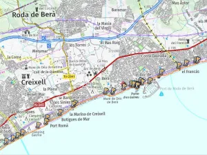
a0327 - St Vicens de Calders to Torredembarra Coastal Walk
An Easy 12.7Km Coastal walk from Coma-ruga to Torredembarra via GR92 passing the picturesque fishing village of El Roc De Santa Gaieta and many natural beaches.
Transport: Regional Fare: €14.00 Distance: 12.7 km Difficulty: Easy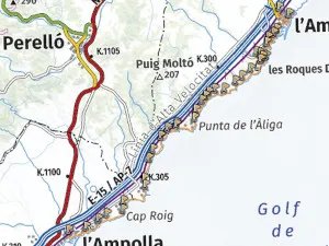
a0328 - Ametlla de Mar to Ampolla coastal walk
A linear coastal walk south of Tarragona from via remote beaches and bays of Ribes Altes, Bon Capo, Estany port, Les Santes Creus, L'Estany podrit and Cala Moros.
Transport: Regional Fare: €22.50 Distance: 17.00 km Difficulty: Moderate